
ስዕል:Colonisation 1885.png

ዋና ፋይል (1,200 × 526 ፒክስል፤ መጠን፦ 206 KB፤ የMIME ዓይነት፦ image/png)
| ማጠቃለያ |
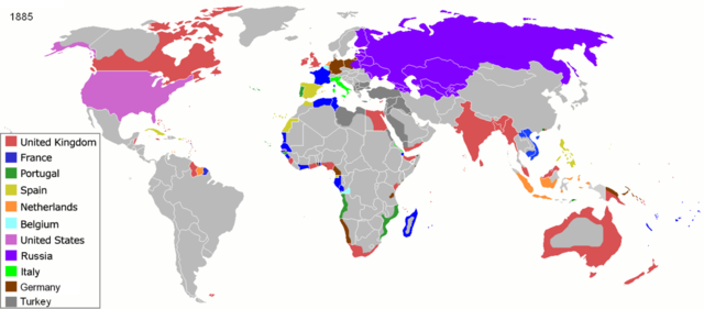
Map of major world powers by year, derived from public domain animated map on wikipedia.
As the orriginal licence of the animation was Public Domain, this image which has been derived from it is too:
|
||||||||||||||||||
| ቀን | |||||||||||||||||||
| ምንጭ | public domain animated map by ArdadN here | ||||||||||||||||||
| አቅራቢው | ArdadN | ||||||||||||||||||
.jpg)
._LOC_2001620596.jpg)

|
This historical map image could be re-created using vector graphics as an SVG file. This has several advantages; see Commons:Media for cleanup for more information. If an SVG form of this image is available, please upload it and afterwards replace this template with
{{vector version available|new image name}}.
It is recommended to name the SVG file “Colonisation 1885.svg”—then the template Vector version available (or Vva) does not need the new image name parameter. |
የፋይሉ ታሪክ
የቀድሞው ዕትም ካለ ቀን/ሰዓቱን በመጫን መመልከት ይቻላል።
| ቀን /ሰዓት | ናሙና | ክልሉ (በpixel) | አቅራቢው | ማጠቃለያ | |
|---|---|---|---|---|---|
| ያሁኑኑ | 09:05, 8 ኖቬምበር 2021 | | 1,200 × 526 (206 KB) | Randomastwritter | jubaland |
| 09:52, 5 ኤፕሪል 2020 |  | 1,200 × 526 (206 KB) | Ориенталист | South Sakhalin was part of Russia in 1885 | |
| 11:17, 2 ሜይ 2015 |  | 1,425 × 625 (49 KB) | Chrischerf | German Empire and colonies in 1885; Sudan under control of the Mahdi | |
| 02:57, 3 ኦገስት 2014 |  | 1,425 × 625 (54 KB) | Alvin Lee | correcting the boundaries of Russia and China | |
| 13:54, 3 ኖቬምበር 2013 |  | 1,425 × 625 (78 KB) | McZusatz | Reverted to version as of 00:22, 24 January 2011 [corrupt file?] | |
| 15:24, 3 ኖቬምበር 2012 |  | 1,425 × 625 (67 KB) | Franco310397 | Spanish presence in Micronesia (Oceania) included in the Captaincy General of the Philippines. In the Caroline Islands and the Mariana Islands. | |
| 00:22, 24 ጃንዩዌሪ 2011 |  | 1,425 × 625 (78 KB) | Micsha~commonswiki | Reverted to version as of 02:17, 3 May 2010 | |
| 00:22, 24 ጃንዩዌሪ 2011 |  | 506 × 326 (85 KB) | Micsha~commonswiki | Only Africa; includes map key | |
| 02:17, 3 ሜይ 2010 |  | 1,425 × 625 (78 KB) | Kieran4 | slight edit | |
| 02:14, 3 ሜይ 2010 |  | 1,425 × 625 (78 KB) | Kieran4 | Correct Dutch East INdies |
መያያዣዎች
የሚከተለው ገጽ ወደዚሁ ፋይል ተያይዟል፦
ሌሎች ውኪዎች
የሚከተሉት ሌሎች ውኪዎች ይህን ፋይል ይጠቀማሉ፦
- Usage on de.wikipedia.org
- Usage on en.wikipedia.org
- Usage on es.wikipedia.org
- Usage on fr.wikipedia.org
- Usage on he.wikipedia.org
- Usage on oc.wikipedia.org
- Usage on sk.wikipedia.org