
ስዕል:Great Lakes from space crop labeled.jpg
ከዚህ በላይ ማጉላት አይቻልም።
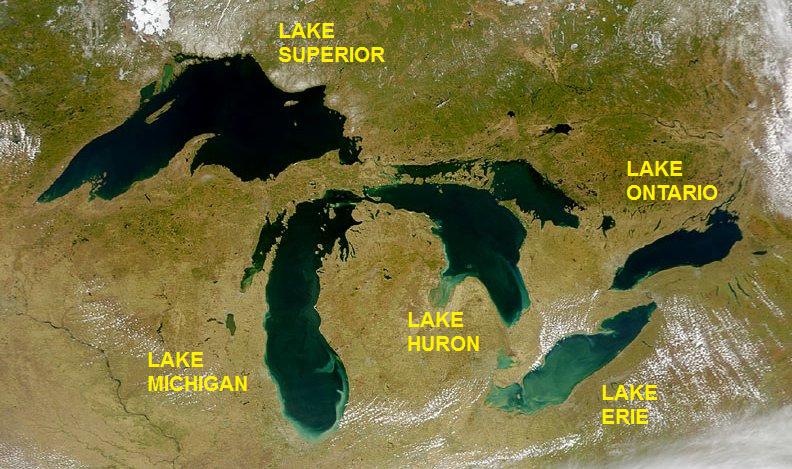
Great_Lakes_from_space_crop_labeled.jpg (792 × 469 ፒክስል፤ መጠን፦ 96 KB፤ የMIME ዓይነት፦ image/jpeg)
ማጠቃለያ
| ማጠቃለያ | Satellite image of the Great Lakes from space |
| ቀን | |
| ምንጭ | http://visibleearth.nasa.gov/view_rec.php?id=793 |
| አቅራቢው | SeaWiFS Project, NASA/Goddard Space Flight Center, and ORBIMAGE; cropped and labeled by Beyond My Ken (talk) 05:49, 11 September 2012 (UTC) |
| ሌሎች ዕትሞች |
  |
የፈቃድ አይነት፦
| This image is from the Sea-viewing Wide Field-of-view Sensor (SeaWiFS) Project and more than 5 years old.
Satellite data captured by the SeaWIFS sensor are released into the public domain 5 years after capture. Data less than five years old can be re-used only for educational or scientific purposes; any commercial use of such images must be coordinated with GeoEye. [1] |
| This work has been released into the public domain by its copyright holder, GeoEye. This applies worldwide. In some countries this may not be legally possible; if so: GeoEye grants anyone the right to use this work for any purpose, without any conditions, unless such conditions are required by law.
|
የፋይሉ ታሪክ
የቀድሞው ዕትም ካለ ቀን/ሰዓቱን በመጫን መመልከት ይቻላል።
| ቀን /ሰዓት | ናሙና | ክልሉ (በpixel) | አቅራቢው | ማጠቃለያ | |
|---|---|---|---|---|---|
| ያሁኑኑ | 05:49, 11 ሴፕቴምበር 2012 | | 792 × 469 (96 KB) | Beyond My Ken | == {{int:filedesc}} == {{Information |Description= Satellite image of the Great Lakes from space |Source= http://visibleearth.nasa.gov/view_rec.php?id=793 |Date= 2000-04-24 |Author= SeaWiFS Project, NASA/Goddard Space Flight Center, and ORBIMAGE; cropp... |
መያያዣዎች
የሚከተለው ገጽ ወደዚሁ ፋይል ተያይዟል፦
ሌሎች ውኪዎች
የሚከተሉት ሌሎች ውኪዎች ይህን ፋይል ይጠቀማሉ፦
- Usage on as.wikipedia.org
- Usage on be.wikipedia.org
- Usage on bh.wikipedia.org
- Usage on bn.wikipedia.org
- Usage on bs.wikipedia.org
- Usage on bxr.wikipedia.org
- Usage on ce.wikipedia.org
- Usage on ckb.wikipedia.org
- Usage on en.wikipedia.org
- Usage on en.wikibooks.org
- Usage on eo.wikipedia.org
- Usage on eu.wikipedia.org
- Usage on gl.wikipedia.org
- Usage on he.wikipedia.org
- Usage on he.wikivoyage.org
- Usage on hy.wikipedia.org
- Usage on ilo.wikipedia.org
- Usage on lfn.wikipedia.org
- Usage on mai.wikipedia.org
- Usage on ne.wikipedia.org
- Usage on new.wikipedia.org
- Usage on pa.wikipedia.org
- Usage on pt.wikipedia.org
- Usage on udm.wikipedia.org
- Usage on uz.wikipedia.org