
ስዕል:LocationComoros.png
ከዚህ በላይ ማጉላት አይቻልም።
LocationComoros.png (250 × 119 ፒክስል፤ መጠን፦ 5 KB፤ የMIME ዓይነት፦ image/png)
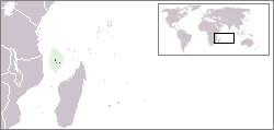
Locator map for the Comoros.
Originally created for English Wikipedia by Vardion.
| |
This work has been released into the public domain by its author, Vardion, at the እንግሊዝኛ ውክፔዲያ project. This applies worldwide. In case this is not legally possible: |

|
File:LocationComoros.svg is a vector version of this file. It should be used in place of this PNG file when not inferior.
File:LocationComoros.png → File:LocationComoros.svg
For more information, see Help:SVG. |
 |
የፋይሉ ታሪክ
የቀድሞው ዕትም ካለ ቀን/ሰዓቱን በመጫን መመልከት ይቻላል።
| ቀን /ሰዓት | ናሙና | ክልሉ (በpixel) | አቅራቢው | ማጠቃለያ | |
|---|---|---|---|---|---|
| ያሁኑኑ | 14:22, 5 ማርች 2008 | | 250 × 119 (5 KB) | Panos84 | Location of the island nation of Comoros and its exclusive economic zone. |
| 23:00, 11 ዲሴምበር 2004 |  | 250 × 115 (6 KB) | EugeneZelenko | Location map for the Comoros.<br/>Originally created for English Wikipedia by Vardion.<br/>{{PD}}<br/>Category:Country locator maps |
መያያዣዎች
ወዲህ ፋይል የተያያዘ ገጽ የለም።
ሌሎች ውኪዎች
የሚከተሉት ሌሎች ውኪዎች ይህን ፋይል ይጠቀማሉ፦
- Usage on ar.wikipedia.org
- Usage on bg.wikipedia.org
- Usage on bpy.wikipedia.org
- Usage on bs.wikipedia.org
- Usage on ceb.wikipedia.org
- Usage on de.wikinews.org
- Usage on de.wiktionary.org
- Usage on en.wikipedia.org
- Usage on en.wikivoyage.org
- Usage on en.wiktionary.org
- Usage on eo.wikipedia.org
- Usage on es.wikipedia.org
- Usage on eu.wiktionary.org
- Usage on frp.wikipedia.org
- Usage on fr.wikipedia.org
- Usage on fr.wiktionary.org
- Usage on he.wikivoyage.org
- Usage on hif.wikipedia.org
- Usage on hr.wiktionary.org
- Usage on hu.wikipedia.org
View more global usage of this file.