
ስዕል:Mali adm location map.svg

ዋና ፋይል (የSVG ፋይል፡ በተግባር 1,644 × 1,568 ፒክስል፤ መጠን፦ 301 KB)
ማጠቃለያ
| ማጠቃለያ |
Deutsch: Positionskarte von Mali
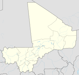
English: Location map of Mali
|
||||||||||||
| ቀን | |||||||||||||
| ምንጭ |
Own work using:
|
||||||||||||
| አቅራቢው | NordNordWest | ||||||||||||
| ሌሎች ዕትሞች |
|
||||||||||||
_location_map.svg)

|
This map has been made or improved in the German Kartenwerkstatt (Map Lab). You can propose maps to improve as well.
|
የፈቃድ አይነት፦
Usage of this file with:

explanatory notes: Legally binding is only the full legalcode. For a free usage I recommend to respect the following licence conditions:
1. Provide my name as given above: NordNordWest,
2. a copy of, or the URI for, the applicable license: https://creativecommons.org/licenses/by-sa/3.0/de/legalcode,
3. the title of the work,
4. in the case of an adaptation, a credit identifying the use of the work in the adaptation.
This license and the rights granted hereunder will terminate automatically upon any breach by you of the terms of this license. Any of the above conditions can be waived if you get permission from the copyright holder. If you have questions or wish differing conditions, please contact me through nnwest or my discussion page ![]() t-online.de
t-online.de
- You are free:
- to share – to copy, distribute and transmit the work
- to remix – to adapt the work
- Under the following conditions:
- attribution – You must give appropriate credit, provide a link to the license, and indicate if changes were made. You may do so in any reasonable manner, but not in any way that suggests the licensor endorses you or your use.
- share alike – If you remix, transform, or build upon the material, you must distribute your contributions under the same or compatible license as the original.

የፋይሉ ታሪክ
የቀድሞው ዕትም ካለ ቀን/ሰዓቱን በመጫን መመልከት ይቻላል።
| ቀን /ሰዓት | ናሙና | ክልሉ (በpixel) | አቅራቢው | ማጠቃለያ | |
|---|---|---|---|---|---|
| ያሁኑኑ | 20:25, 18 ሜይ 2019 | | 1,644 × 1,568 (301 KB) | NordNordWest | upd |
| 13:43, 30 ኖቬምበር 2014 |  | 1,644 × 1,568 (297 KB) | NordNordWest | == {{int:filedesc}} == {{Information |Description= {{de|1=Positionskarte von Mali}} {{en|1=Location map of Mali}} {{Location map series N |stretching=105 |top=25.5 |bottom=9.7 |left=-12.6 |right=4.8 }} |Source={{Own using}} * United States National Ima... |
መያያዣዎች
የሚከተለው ገጽ ወደዚሁ ፋይል ተያይዟል፦
ሌሎች ውኪዎች
የሚከተሉት ሌሎች ውኪዎች ይህን ፋይል ይጠቀማሉ፦
- Usage on af.wikipedia.org
- Usage on an.wikipedia.org
- Usage on ar.wikipedia.org
- Usage on arz.wikipedia.org
- Usage on ast.wikipedia.org
- Usage on azb.wikipedia.org
- Usage on az.wikipedia.org
- Usage on ba.wikipedia.org
- Usage on be-tarask.wikipedia.org
- Usage on be.wikipedia.org
View more global usage of this file.