
ስዕል:Mary's River Covered Bridge.jpg

Size of this preview: 800 × 600 pixels. Other resolutions: 320 × 240 pixels | 640 × 480 pixels | 1,024 × 768 pixels | 1,280 × 960 pixels | 2,560 × 1,920 pixels | 2,816 × 2,112 pixels.
ዋና ፋይል (2,816 × 2,112 ፒክስል፤ መጠን፦ 2.57 MB፤ የMIME ዓይነት፦ image/jpeg)
|
This is an image of a place or building that is listed on the National Register of Historic Places in the United States of America. Its reference number is 74000771. |
| Camera location | | View this and other nearby images on: OpenStreetMap |
|---|
| ማጠቃለያ |
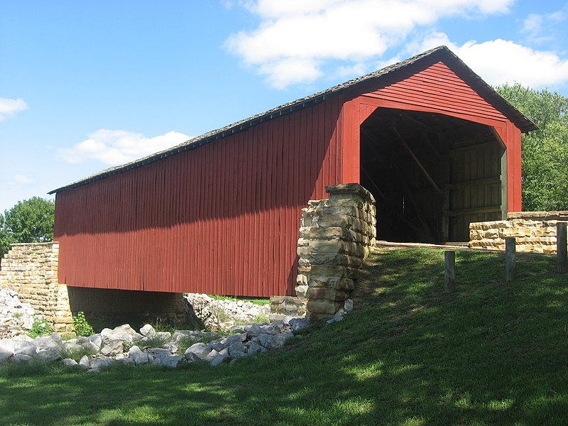
English: Southern portal and western side of the Mary's River Covered Bridge, which carries the old roadbed of Illinois Route 150 over the Little Marys River north of Chester in Randolph County, Illinois, United States. Built in 1854, it is listed on the National Register of Historic Places. |
||
| ቀን | Taken on 8 ሴፕቴምበር 2012 | ||
| ምንጭ | Own work | ||
| አቅራቢው | Nyttend | ||
| የማብዛት ፈቃድ (Reusing this file) |
|
የፋይሉ ታሪክ
የቀድሞው ዕትም ካለ ቀን/ሰዓቱን በመጫን መመልከት ይቻላል።
| ቀን /ሰዓት | ናሙና | ክልሉ (በpixel) | አቅራቢው | ማጠቃለያ | |
|---|---|---|---|---|---|
| ያሁኑኑ | 21:31, 7 ኦክቶበር 2012 | | 2,816 × 2,112 (2.57 MB) | Nyttend | {{NRHP|74000771}} {{Location|37|56|54|N|89|45|57|W}} {{Information |Description={{en|Southern portal and western side of the {{w|Mary's River Covered Bridge}}, which carries the old roadbed of {{w|Illinois Route 150}} over the {{w|Little Marys River (I... |
መያያዣዎች
የሚከተለው ገጽ ወደዚሁ ፋይል ተያይዟል፦
ሌሎች ውኪዎች
የሚከተሉት ሌሎች ውኪዎች ይህን ፋይል ይጠቀማሉ፦
- Usage on ban.wikipedia.org
- Usage on ceb.wikipedia.org
- Usage on cv.wikipedia.org
- Usage on de.wikipedia.org
- Usage on el.wikipedia.org
- Usage on en.wikipedia.org
- Usage on frp.wikipedia.org
- Usage on id.wikipedia.org
- Usage on nn.wikipedia.org
- Usage on se.wikipedia.org
- Usage on te.wikipedia.org
- Usage on wa.wikipedia.org
- Usage on www.wikidata.org