
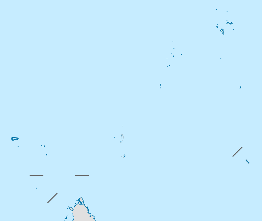
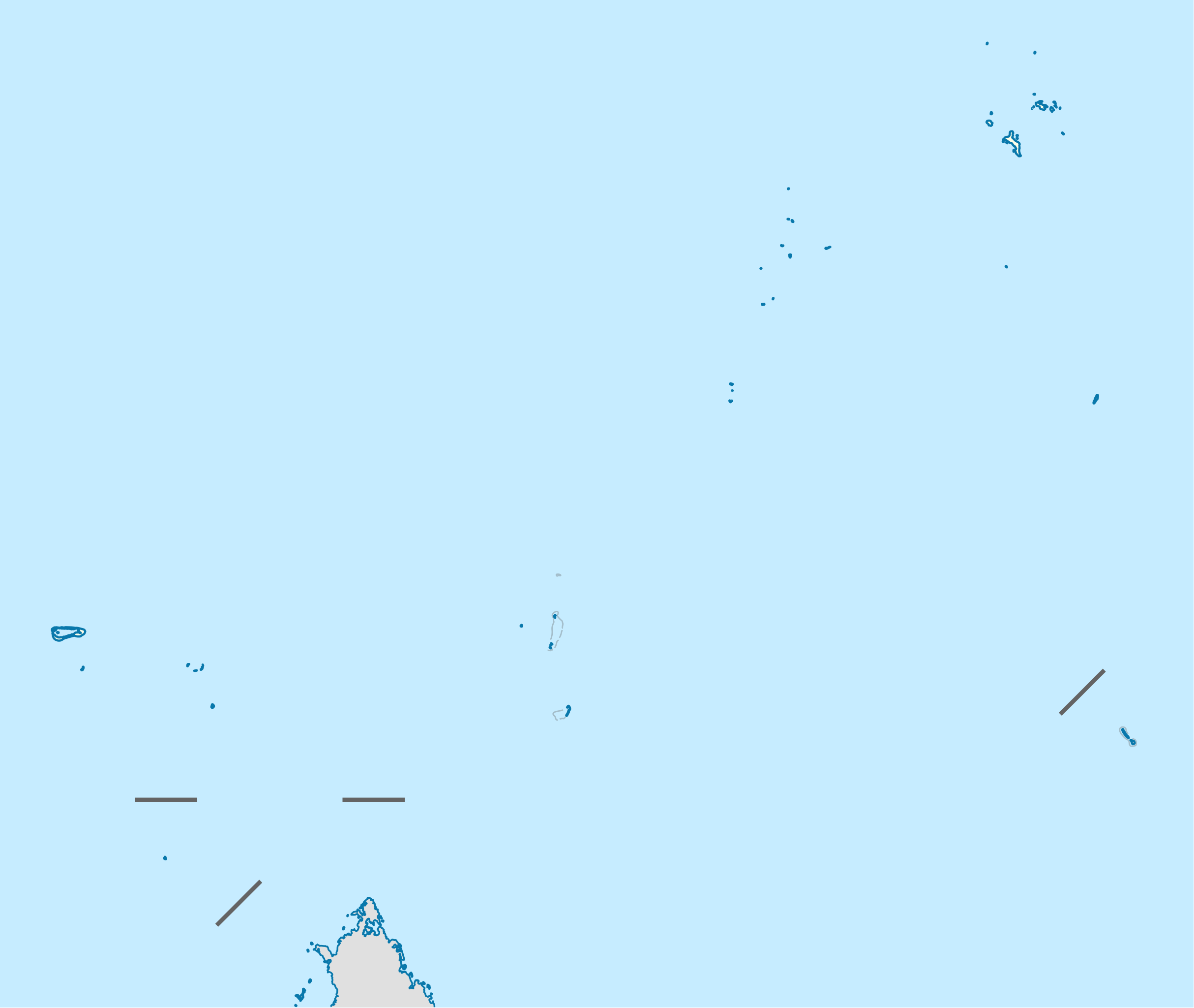
ስዕል:Seychelles location map.svg

Size of this PNG preview of this SVG file: 711 × 600 pixels. Other resolutions: 285 × 240 pixels | 569 × 480 pixels | 910 × 768 pixels | 1,214 × 1,024 pixels | 2,428 × 2,048 pixels | 1,087 × 917 pixels.
ዋና ፋይል (የSVG ፋይል፡ በተግባር 1,087 × 917 ፒክስል፤ መጠን፦ 80 KB)
ማጠቃለያ
| ማጠቃለያ |
Deutsch: Positionskarte der Seychellen
Quadratische Plattkarte. Geographische Begrenzung der Karte:
English: Location map of Seychelles
Equirectangular projection. Geographic limits of the map:
|
| ቀን | |
| ምንጭ | Own work, using United States National Imagery and Mapping Agency data |
| አቅራቢው | NordNordWest |
| የማብዛት ፈቃድ (Reusing this file) |
I, the copyright holder of this work, hereby publish it under the following license: This file is licensed under the Creative Commons Attribution-Share Alike 3.0 Unported license.
|

|
This map has been made or improved in the German Kartenwerkstatt (Map Lab). You can propose maps to improve as well.
|
የፋይሉ ታሪክ
የቀድሞው ዕትም ካለ ቀን/ሰዓቱን በመጫን መመልከት ይቻላል።
| ቀን /ሰዓት | ናሙና | ክልሉ (በpixel) | አቅራቢው | ማጠቃለያ | |
|---|---|---|---|---|---|
| ያሁኑኑ | 14:55, 20 ኦክቶበር 2009 | | 1,087 × 917 (80 KB) | NordNordWest | {{int:filedesc}} {{Information |Description= {{de|Positionskarte der Seychellen}} Quadratische Plattkarte. Geographische Begrenzung der Karte: * N: 3.3° S * S: 13.0° S * W: 45.7° O * O: 57.2° O {{en|Location map of [[:en:Seychelles| |
መያያዣዎች
የሚከተለው ገጽ ወደዚሁ ፋይል ተያይዟል፦
ሌሎች ውኪዎች
የሚከተሉት ሌሎች ውኪዎች ይህን ፋይል ይጠቀማሉ፦
- Usage on af.wikipedia.org
- Usage on an.wikipedia.org
- Usage on ar.wikipedia.org
- Usage on ast.wikipedia.org
- Usage on az.wikipedia.org
- Usage on be-tarask.wikipedia.org
- Usage on be.wikipedia.org
- Usage on bg.wikipedia.org
- Usage on bn.wikipedia.org
- Usage on bs.wikipedia.org
- Usage on ceb.wikipedia.org
View more global usage of this file.