
ስዕል:Somaliland map.png
ከዚህ በላይ ማጉላት አይቻልም።
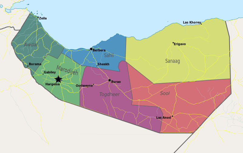
Somaliland_map.png (800 × 504 ፒክስል፤ መጠን፦ 99 KB፤ የMIME ዓይነት፦ image/png)
ማጠቃለያ
| ማጠቃለያ | Map of Somaliland. |
| ቀን | |
| ምንጭ | Own work |
| አቅራቢው | PANONIAN |
የፈቃድ አይነት፦
I, the copyright holder of this work, hereby publish it under the following license:
| This file is made available under the Creative Commons CC0 1.0 Universal Public Domain Dedication. | |
| The person who associated a work with this deed has dedicated the work to the public domain by waiving all of their rights to the work worldwide under copyright law, including all related and neighboring rights, to the extent allowed by law. You can copy, modify, distribute and perform the work, even for commercial purposes, all without asking permission.
|
References
- http://www.sdo.nu/wp-content/uploads/2010/04/map-vd-steden1.gif
- http://www.somaliland.org/images/i/map_somaliland_org.gif
- http://www.somaliland.org/images/b/2007/11/map_somaliland.gif
- http://images.wikia.com/turtledove/images/c/c7/SomalilandMap.jpg
- http://xarbi.files.wordpress.com/2010/11/somaliland-map-in-ai.jpg
- http://cdn-english.alshahid.net/wp-content/uploads/2010/02/somland.jpg?59dea9
- http://www.tothepointnews.com/images/stories/2011/somaliland_map.jpg
- http://xarbi.files.wordpress.com/2010/04/somaliland-map22.jpg
- http://xarbi.files.wordpress.com/2010/05/somaliland-map-20101.jpg
- http://www.afrol.com/images/maps/somaliland_big.gif
የፋይሉ ታሪክ
የቀድሞው ዕትም ካለ ቀን/ሰዓቱን በመጫን መመልከት ይቻላል።
| ቀን /ሰዓት | ናሙና | ክልሉ (በpixel) | አቅራቢው | ማጠቃለያ | |
|---|---|---|---|---|---|
| ያሁኑኑ | 11:55, 10 ሜይ 2021 | | 800 × 504 (99 KB) | Siirski | Update |
| 18:04, 20 ጁን 2020 |  | 1,254 × 741 (42 KB) | Chipmunkdavis | Reverted to version as of 14:41, 2 July 2012 (UTC) Rv unlablled change. The only labelled place is controlled by Somaliland. | |
| 20:31, 17 ጁን 2020 |  | 800 × 473 (64 KB) | Meelpringthusss | clearer color | |
| 02:12, 16 ጁን 2020 |  | 800 × 473 (64 KB) | Meelpringthusss | added disputed areas | |
| 14:41, 2 ጁላይ 2012 |  | 1,254 × 741 (42 KB) | PANONIAN | {{Information |Description=Map of Somaliland. |Source={{own}} |Date=2012 |Author= PANONIAN |Permission= |other_versions= }} |
መያያዣዎች
ወዲህ ፋይል የተያያዘ ገጽ የለም።
ሌሎች ውኪዎች
የሚከተሉት ሌሎች ውኪዎች ይህን ፋይል ይጠቀማሉ፦
- Usage on arz.wikipedia.org
- Usage on be.wikipedia.org
- Usage on bn.wikipedia.org
- Usage on bs.wikipedia.org
- Usage on ca.wikipedia.org
- Usage on crh.wikipedia.org
- Usage on dv.wikipedia.org
- Usage on ga.wikipedia.org
- Usage on hr.wikipedia.org
- Usage on hy.wikipedia.org
- Usage on incubator.wikimedia.org
- Usage on ms.wikipedia.org
- Usage on oc.wikipedia.org
- Usage on pam.wikipedia.org
- Usage on pnb.wikipedia.org
- Usage on sa.wikipedia.org
- Usage on sco.wikipedia.org
- Usage on sh.wikipedia.org
- Usage on sk.wikipedia.org
- Usage on so.wikipedia.org
- Usage on sr.wikipedia.org
- Usage on su.wikipedia.org
- Usage on ta.wikipedia.org
- Usage on tl.wikipedia.org
- Usage on tr.wikipedia.org
- Usage on ur.wikipedia.org
- Usage on xmf.wikipedia.org