
ስዕል:Crimea neutral map02.png

Size of this preview: 800 × 531 pixels. Other resolutions: 320 × 212 pixels | 640 × 425 pixels | 1,031 × 684 pixels.
ዋና ፋይል (1,031 × 684 ፒክስል፤ መጠን፦ 60 KB፤ የMIME ዓይነት፦ image/png)
ማጠቃለያ
| ማጠቃለያ |
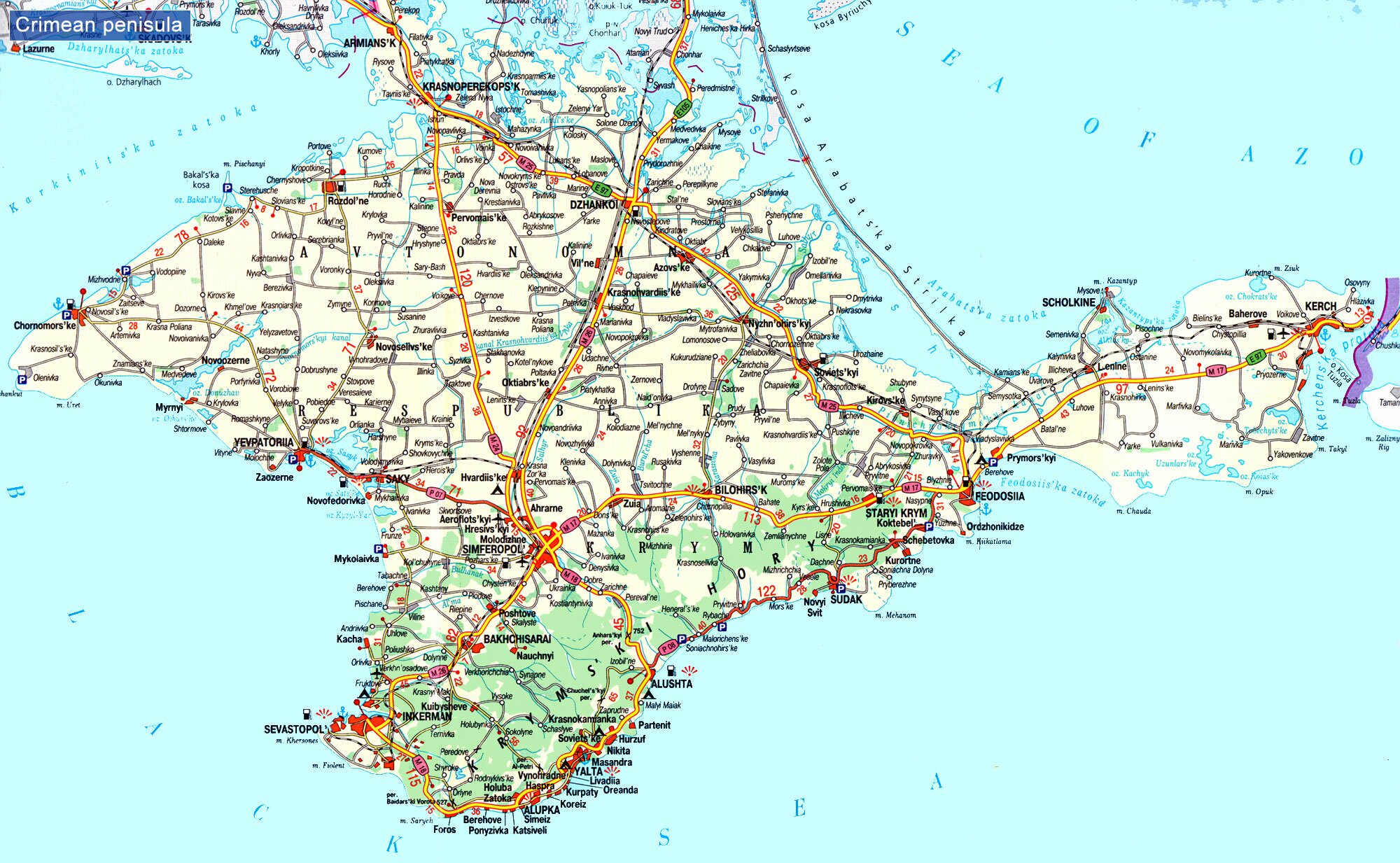
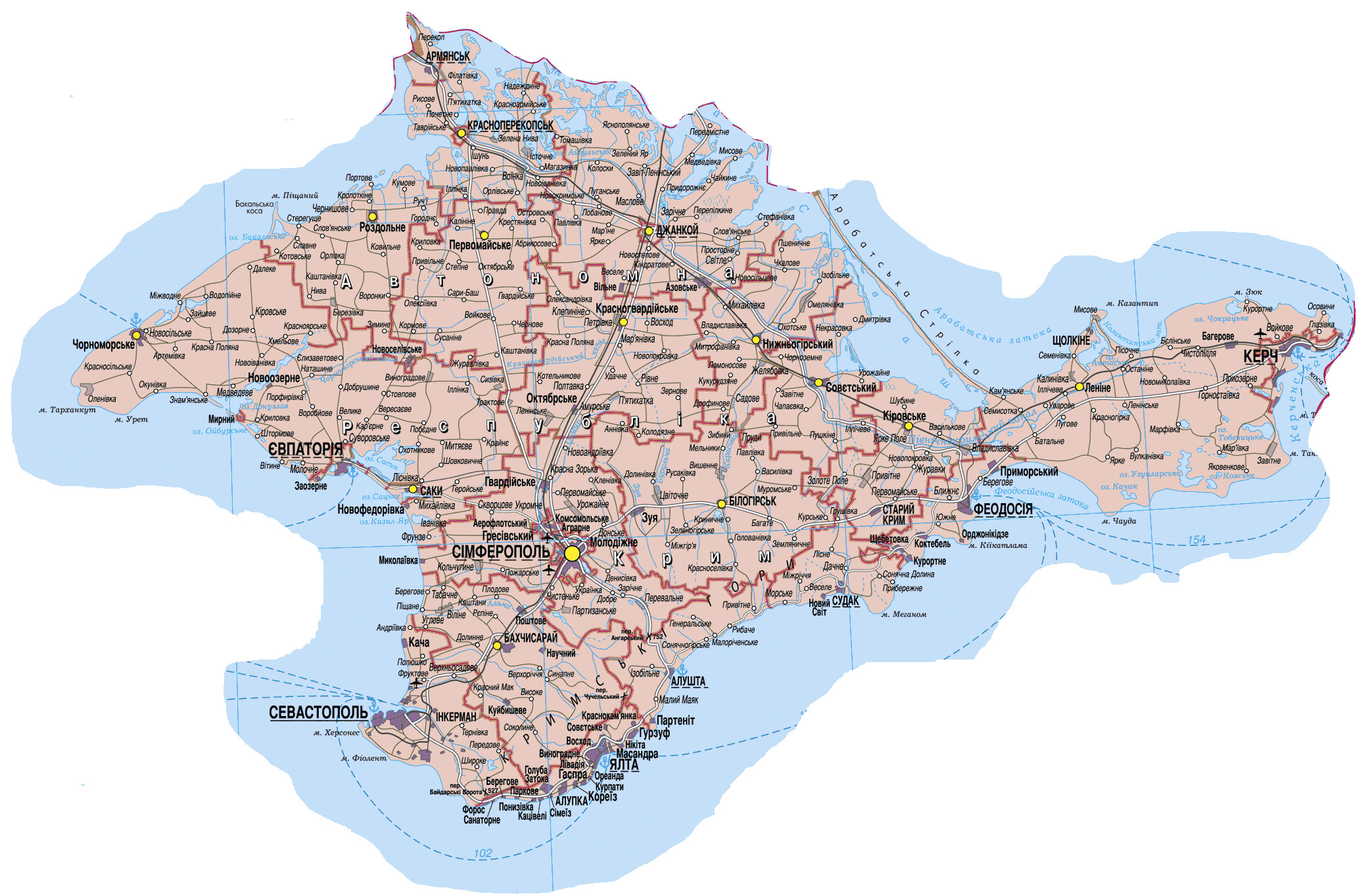
English: Politically neutral map of the disputed region of Crimea. Српски / srpski: Политички неутрална мапа спорне регије Крим. |
| ቀን | |
| ምንጭ | Own work |
| አቅራቢው | PANONIAN |
የፈቃድ አይነት፦
I, the copyright holder of this work, hereby publish it under the following license:
| This file is made available under the Creative Commons CC0 1.0 Universal Public Domain Dedication. | |
| The person who associated a work with this deed has dedicated the work to the public domain by waiving all of their rights to the work worldwide under copyright law, including all related and neighboring rights, to the extent allowed by law. You can copy, modify, distribute and perform the work, even for commercial purposes, all without asking permission.
|
References
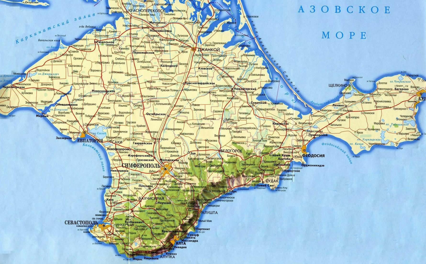
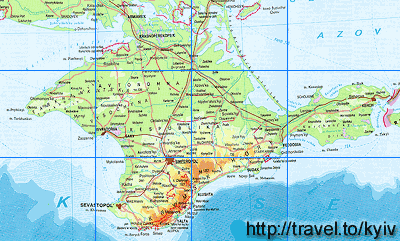
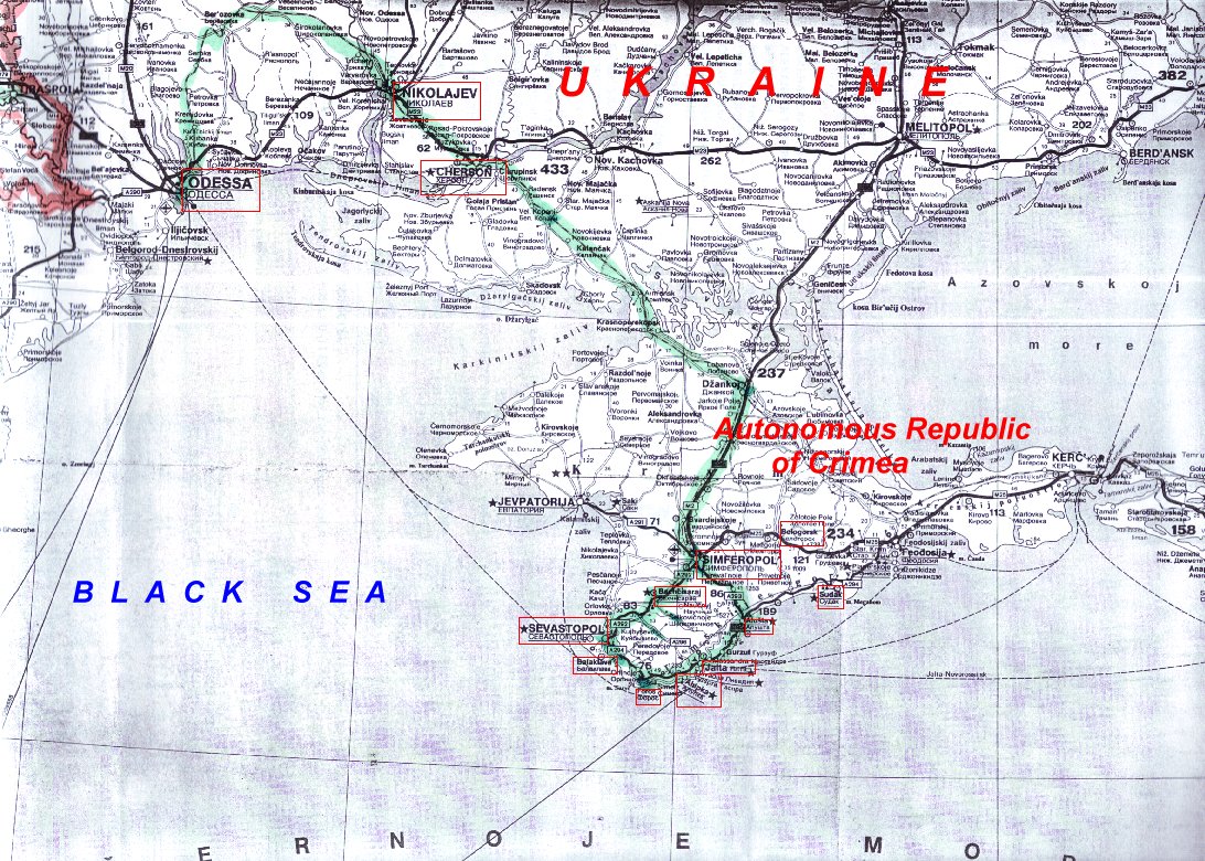
Maps from external links - entire Crimea:
- http://eurodialogue.org/files/fckeditor_files/crimea-map.gif
- http://www.lonelyplanet.com/maps/europe/ukraine/crimea/map_of_crimea.jpg
- http://www.rentmyflatinfeodosia.com/feodosia_guide/images/crimea_map2.jpg
- http://www.ukraine-travels.com/ukrainian-cities/images/crimea/crimea-map-s.jpg
- http://www.ua-business.com.ua/wp-content/uploads/2010/04/Canadian-investment-to-Crimea.jpg
- http://www.perekop.net/wp-content/uploads/crimea-map.gif
- http://mappery.com/maps/Crimea-Peninsula-Map.jpg
- http://www.globalsecurity.org/military/world/ukraine/images/crimea-map1.jpg
- http://www.riverofjoy-crimea.org/sitebuilder/images/Light_of_Crimea_TOPOGRAPHICAL_MAP_w_callouts-816x660.jpg
- http://www.mt.crimea.com/image/map_of_crimea.gif
- http://travel.kyiv.org/crimea/map/crimea_l.gif
- http://www.accesscrimea.com/images/map_crimeaprev.gif
- http://www.discover-ua.info/uploads/images/Crimea/map_of_crimea.gif
- http://www.nlminfo.org/userfiles/Image/map%20crimea0201.jpg archive copy at the Wayback Machine
- http://www.crimeamap.com/crimea_images/colorcrimeamap600x450-2.jpg archive copy at the Wayback Machine
- http://ruraltourism.com.ua/uploads/Image/oblast/eng/01.jpg
- http://www.oocities.org/new11world/crimea_map_en.jpg
- http://www.crimeahike.com/images/Crimea_Map_en.jpg archive copy at the Wayback Machine
- http://1.bp.blogspot.com/_-IladB6V24I/SPlo3CapnxI/AAAAAAAAB_E/OyjdgvtBpgU/s400/03.MapCrimea.Added..jpg
- http://weecheng.com/europe/bbs/crimea/crimea-map.jpg
- http://www.travel2crimea.com/image/common/map_of_crimea.png archive copy at the Wayback Machine
- http://www.mapofukraine.net/outdoor_activities/image/rockclimbing/crimea_climbing_map.gif
- http://novaonline.nvcc.edu/eli/evans/Photos/Russia/Yalta/Map.jpg
- http://www.ukrainebiz.com/maps/road_crimea.jpg
- http://coolhaus.de/misc/crimea-map.jpg
- http://russia-map.info/559885_BIG_0_0.jpg
- http://siriys-info.com/uploads/map/map1-crimea-full.jpg[dead link]
- http://siriys-info.com/uploads/map/map3-crimea-full.gif archive copy at the Wayback Machine
- http://siriys-info.com/uploads/map/map2-crimea-full.gif[dead link]
- http://vhodv.com/map/images/map_krym_b.jpg archive copy at the Wayback Machine
- http://our-travels.sumy.ua/ost/foto/Krym/135.jpg[dead link]
- http://www.raster-maps.com/images/maps/rastr/ukraine/atlas/crimea_karta.jpg
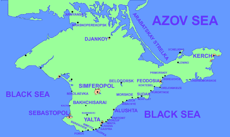
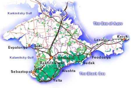
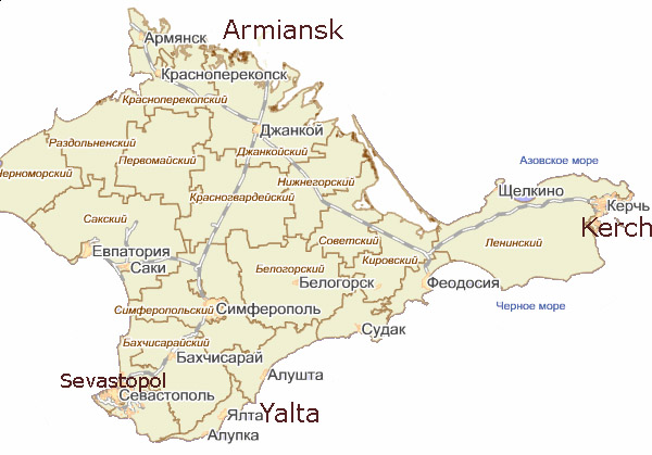
Largest cities and towns in Crimea:
- http://world-gazetteer.com/wg.php?x=&men=gcis&lng=en&des=wg&geo=-220&srt=npan&col=abcdefghinoq&msz=1500&geo=-3726[dead link]
የፋይሉ ታሪክ
የቀድሞው ዕትም ካለ ቀን/ሰዓቱን በመጫን መመልከት ይቻላል።
| ቀን /ሰዓት | ናሙና | ክልሉ (በpixel) | አቅራቢው | ማጠቃለያ | |
|---|---|---|---|---|---|
| ያሁኑኑ | 20:47, 15 ኤፕሪል 2014 | | 1,031 × 684 (60 KB) | PANONIAN | color change |
| 21:45, 21 ማርች 2014 |  | 1,031 × 684 (60 KB) | PANONIAN | {{Information |Description ={{en|1=Politically neutral map of the disputed region of Crimea.}} |Source ={{own}} |Author =PANONIAN |Date =2014 |Permission = |other_versions = }} |
መያያዣዎች
የሚከተለው ገጽ ወደዚሁ ፋይል ተያይዟል፦
ሌሎች ውኪዎች
የሚከተሉት ሌሎች ውኪዎች ይህን ፋይል ይጠቀማሉ፦
- Usage on bs.wikipedia.org
- Usage on hr.wikipedia.org
- Usage on sh.wikipedia.org
- Usage on sr.wikipedia.org