
ስዕል:Niger location map.svg

Size of this PNG preview of this SVG file: 792 × 600 pixels. Other resolutions: 317 × 240 pixels | 634 × 480 pixels | 1,014 × 768 pixels | 1,280 × 970 pixels | 2,560 × 1,939 pixels | 1,006 × 762 pixels.
ዋና ፋይል (የSVG ፋይል፡ በተግባር 1,006 × 762 ፒክስል፤ መጠን፦ 101 KB)
ማጠቃለያ
| ማጠቃለያ |
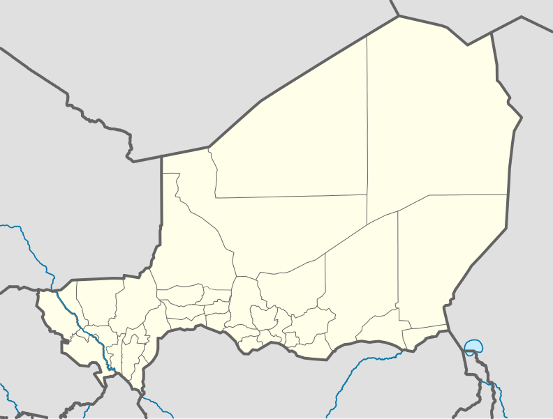
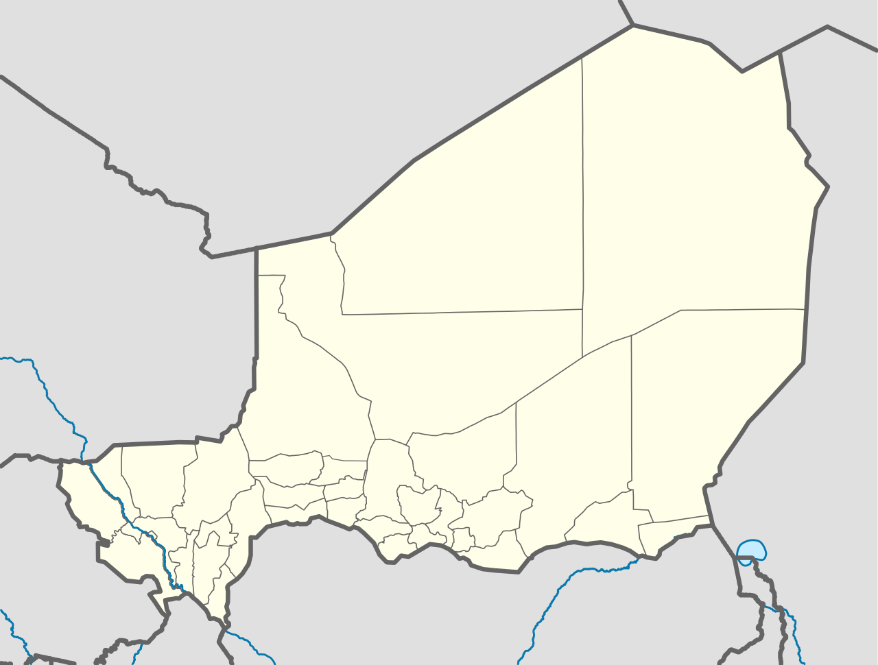
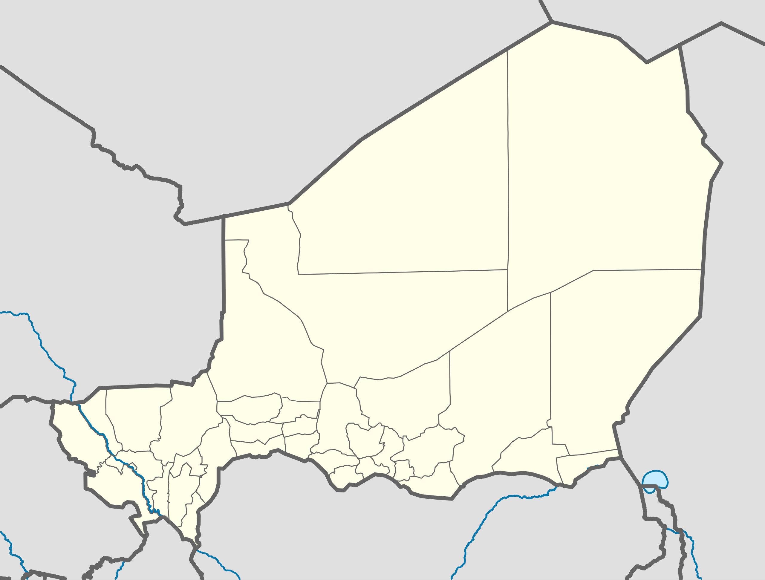
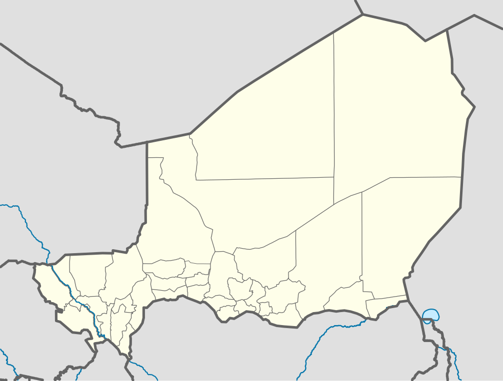
Deutsch: Positionskarte von Niger
Quadratische Plattkarte, N-S-Streckung. Geographische Begrenzung der Karte:
English: Location map of Niger
Equirectangular projection, N/S stretching. Geographic limits of the map:
|
| ቀን | |
| ምንጭ |
Own work, using
|
| አቅራቢው | Carport |
| ሌሎች ዕትሞች |
|
| SVG genesis | This W3C-invalid map was created with Adobe Illustrator. |

የፈቃድ አይነት፦
This file is licensed under the Creative Commons Attribution-Share Alike 2.0 Generic license.
- You are free:
- to share – to copy, distribute and transmit the work
- to remix – to adapt the work
- Under the following conditions:
- attribution – You must give appropriate credit, provide a link to the license, and indicate if changes were made. You may do so in any reasonable manner, but not in any way that suggests the licensor endorses you or your use.
- share alike – If you remix, transform, or build upon the material, you must distribute your contributions under the same or compatible license as the original.
የፋይሉ ታሪክ
የቀድሞው ዕትም ካለ ቀን/ሰዓቱን በመጫን መመልከት ይቻላል።
| ቀን /ሰዓት | ናሙና | ክልሉ (በpixel) | አቅራቢው | ማጠቃለያ | |
|---|---|---|---|---|---|
| ያሁኑኑ | 09:52, 6 ዲሴምበር 2011 | | 1,006 × 762 (101 KB) | NordNordWest | cleanup |
| 13:02, 10 ፌብሩዌሪ 2010 |  | 1,006 × 762 (435 KB) | Carport | {{Information |Description={{de|1=Positionskarte von {{w|Niger|3=de}} {{w|Quadratische Plattkarte|3=de}}, N-S-Streckung. Geographische Begrenzung der Karte: * N: 24° N * S: 11° N * W: 1° W * O: 17° O}} {{en|1=Location map of {{w|Niger}} Equirectangu |
መያያዣዎች
የሚከተለው ገጽ ወደዚሁ ፋይል ተያይዟል፦
ሌሎች ውኪዎች
የሚከተሉት ሌሎች ውኪዎች ይህን ፋይል ይጠቀማሉ፦
- Usage on af.wikipedia.org
- Usage on an.wikipedia.org
- Usage on ar.wikipedia.org
- Usage on ast.wikipedia.org
- Usage on azb.wikipedia.org
- Usage on az.wikipedia.org
- Usage on ba.wikipedia.org
- Usage on be-tarask.wikipedia.org
- Usage on be.wikipedia.org
- Usage on bg.wikipedia.org
- Usage on bn.wikipedia.org
- Usage on br.wikipedia.org
- Usage on bs.wikipedia.org
- Usage on ca.wikipedia.org
- Usage on ceb.wikipedia.org
View more global usage of this file.