
ስዕል:SA in Australia map.png
ከዚህ በላይ ማጉላት አይቻልም።
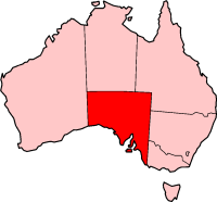
SA_in_Australia_map.png (200 × 186 ፒክስል፤ መጠን፦ 11 KB፤ የMIME ዓይነት፦ image/png)
Variation on our usual theme. QuartierLatin1968 00:01, 22 May 2005 (UTC)

|
Permission is granted to copy, distribute and/or modify this document under the terms of the GNU Free Documentation License, Version 1.2 or any later version published by the Free Software Foundation; with no Invariant Sections, no Front-Cover Texts, and no Back-Cover Texts. A copy of the license is included in the section entitled GNU Free Documentation License. |
| This file is licensed under the Creative Commons Attribution-Share Alike 3.0 Unported license. | ||
| ||
| This licensing tag was added to this file as part of the GFDL licensing update. |

|
File:South Australia in Australia.svg is a vector version of this file. It should be used in place of this PNG file when not inferior.
File:SA in Australia map.png → File:South Australia in Australia.svg
For more information, see Help:SVG. |
 |
የፋይሉ ታሪክ
የቀድሞው ዕትም ካለ ቀን/ሰዓቱን በመጫን መመልከት ይቻላል።
| ቀን /ሰዓት | ናሙና | ክልሉ (በpixel) | አቅራቢው | ማጠቃለያ | |
|---|---|---|---|---|---|
| ያሁኑኑ | 00:01, 22 ሜይ 2005 | | 200 × 186 (11 KB) | QuartierLatin1968 | Variation on our usual theme. ~~~~ {{GFDL}} Category:South Australia Category:Maps of Australia |
መያያዣዎች
የሚከተለው ገጽ ወደዚሁ ፋይል ተያይዟል፦
ሌሎች ውኪዎች
የሚከተሉት ሌሎች ውኪዎች ይህን ፋይል ይጠቀማሉ፦
- Usage on de.wikipedia.org
- Usage on en.wikipedia.org
- Lake Cadibarrawirracanna
- South Australian gulf drainage division
- Australian south-east coast drainage division
- Crawford crater
- Flaxman crater
- List of highways in South Australia
- Wrattonbully
- Adelaide Hills Council
- Balhannah
- District Council of Mount Barker
- Murray Mallee
- Flinders Ranges Council
- Thevenard, South Australia
- Monash, South Australia
- Wellington, South Australia
- Dublin, South Australia
- District Council of Peterborough
- Kingston SE
- Roseworthy, South Australia
- Adelaide Plains
- Mawson Trail
- Mid North
- Coonawarra, South Australia
- Oak Valley, South Australia
- Dalhousie Springs
- Lake Gregory (South Australia)
- Kingston On Murray, South Australia
- Clarendon, South Australia
- Template:SouthAustralia-geo-stub
- Hoyleton, South Australia
- Brinkworth, South Australia
- Summertown, South Australia
- Painted Desert (South Australia)
- Taldra, South Australia
- Taplan, South Australia
- Tarcowie, South Australia
- Tarlee, South Australia
- Templers, South Australia
- Two Wells, South Australia
- Glendambo, South Australia
- Wudinna, South Australia
- English Island (South Australia)
- Rowland Flat, South Australia
- Lyndoch, South Australia
- Barossa Range
- Angaston, South Australia
- Eden Valley, South Australia
- Mengler Hill
View more global usage of this file.