ስዕል:BlankMap-Europe.png

Page contents not supported in other languages.
ከውክፔዲያ

BlankMap-Europe.png(450 × 422 ፒክስል፤ መጠን፦ 15 KB፤ የMIME ዓይነት፦ image/png)

ይህ ፋይል ከWikimedia Commons የተቀሰመ ነው እና በሌላ ዊኪ ላይ ሊጠቅም ይችላል። በhttps://commons.wikimedia.org/wiki/File:BlankMap-Europe.png ላይ የሚገኘው የፋይሉ መግለጫ ከዚህ በታች ቀርቧል።

ማጠቃለያ

ማጠቃለያ
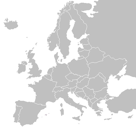
English: A blank political map of Europe as of 2004 (updated 2006 and 2008), made by the uploader for Wikipedia.
The list of independent states pictured on the map (source): Albania, Andorra, Austria, Belarus, Belgium, Bosnia and Herzegovina, Bulgaria, Croatia, Czech Republic, Cyprus, Denmark, Estonia, Finland, France, Germany, Greece, Hungary, Iceland, Ireland, Italy, Latvia, Liechtenstein, Lithuania, Luxembourg, Kosovo (disputed), Macedonia, Moldova, Monaco, Montenegro, Netherlands, Norway, Poland, Portugal, Romania, Russia, San Marino, Serbia, Slovakia, Slovenia, Spain, Sweden, Switzerland, Turkey, Ukraine, United Kingdom, Vatican City
ቀን 16 ኖቬምበር 2003 (original upload date)
ምንጭ Own work
አቅራቢው Vardion at እንግሊዝኛ ውክፔዲያ

የፈቃድ አይነት፦

Public domain I, the copyright holder of this work, release this work into the public domain. This applies worldwide.
In some countries this may not be legally possible; if so:
I grant anyone the right to use this work for any purpose, without any conditions, unless such conditions are required by law.

Original upload log

The original description page was here. All following user names refer to en.wikipedia.
  • 2006-06-10 12:08 Astrokey44 422×422 (10216 bytes) montenegro independent
  • 2006-04-23 18:32 Lgriot 450×422 (7164 bytes) Reverted to earlier revision
  • 2006-04-23 18:32 Lgriot 415×422 (9421 bytes) Reverted to earlier revision
  • 2006-02-22 07:01 BionicWilliam 450×422 (9812 bytes) Reverted to earlier revision
  • 2006-02-22 07:01 BionicWilliam 415×422 (9421 bytes) Reverted to earlier revision
  • 2006-01-04 08:52 E Pluribus Anthony 450×422 (9812 bytes) Blank map of Europe (2005)
  • 2005-09-22 18:14 E Pluribus Anthony 450×422 (9805 bytes) Blank map of Europe (2005)
  • 2005-09-19 09:15 E Pluribus Anthony 450×422 (9804 bytes) Blank map of Europe, 2005
  • 2005-09-19 06:45 E Pluribus Anthony 450×422 (7164 bytes) Blank map of Europe
  • 2005-07-21 05:05 MishaChan 415×422 (5477 bytes) Reverted to earlier revision
  • 2005-07-21 05:04 MishaChan 415×422 (9421 bytes) Reverted to earlier revision
  • 2005-01-22 16:48 Richie 415×422 (5477 bytes) modified Ireland (border), Orkney, Shetlands
  • 2004-09-07 10:53 Gobnuts 415×422 (9421 bytes) Reverted to earlier revision
  • 2004-09-07 10:51 Gobnuts 415×422 (9410 bytes) Reverted to earlier revision
  • 2003-11-16 08:07 Vardion 415×422 (9421 bytes) Blank map of Europe (corrected again)
  • 2003-11-16 08:04 Vardion 415×422 (9410 bytes) Blank map of Europe (corrected)
  • 2003-11-16 07:16 Vardion 415×430 (9113 bytes) Blank map of Europe

Captions

Add a one-line explanation of what this file represents

Items portrayed in this file

depicts እንግሊዝኛ

inception እንግሊዝኛ

16 ኖቬምበር 2003

media type እንግሊዝኛ

image/png

source of file እንግሊዝኛ

original creation by uploader እንግሊዝኛ

checksum እንግሊዝኛ

fd8d2f1165f0bd5741de4e44d0bdfd3444feb56e

determination method እንግሊዝኛ: SHA-1 እንግሊዝኛ

data size እንግሊዝኛ

14,906 byte

422 pixel

width እንግሊዝኛ

450 pixel

የፋይሉ ታሪክ

የቀድሞው ዕትም ካለ ቀን/ሰዓቱን በመጫን መመልከት ይቻላል።

(ኋለኞች | ቀድመኞች) በቁጥር ለማየት፡ (ኋለኛ 10) () (10 | 20 | 50 | 100 | 250 | 500).
ቀን /ሰዓትናሙናክልሉ (በpixel)አቅራቢውማጠቃለያ
ያሁኑኑ22:02, 23 ሴፕቴምበር 2015በ22:02, 23 ሴፕቴምበር 2015 የነበረው ዕትም ናሙና450 × 422 (15 KB)OgreBot(BOT): Reverting to most recent version before archival
22:02, 23 ሴፕቴምበር 2015በ22:02, 23 ሴፕቴምበር 2015 የነበረው ዕትም ናሙና450 × 422 (10 KB)OgreBot(BOT): Uploading old version of file from en.wikipedia; originally uploaded on 2006-01-04 08:52:21 by E Pluribus Anthony
22:02, 23 ሴፕቴምበር 2015በ22:02, 23 ሴፕቴምበር 2015 የነበረው ዕትም ናሙና450 × 422 (10 KB)OgreBot(BOT): Uploading old version of file from en.wikipedia; originally uploaded on 2005-09-22 18:14:10 by E Pluribus Anthony
22:02, 23 ሴፕቴምበር 2015በ22:02, 23 ሴፕቴምበር 2015 የነበረው ዕትም ናሙና450 × 422 (10 KB)OgreBot(BOT): Uploading old version of file from en.wikipedia; originally uploaded on 2005-09-19 09:15:43 by E Pluribus Anthony
22:02, 23 ሴፕቴምበር 2015በ22:02, 23 ሴፕቴምበር 2015 የነበረው ዕትም ናሙና450 × 422 (7 KB)OgreBot(BOT): Uploading old version of file from en.wikipedia; originally uploaded on 2005-09-19 06:45:22 by E Pluribus Anthony
22:02, 23 ሴፕቴምበር 2015በ22:02, 23 ሴፕቴምበር 2015 የነበረው ዕትም ናሙና415 × 422 (5 KB)OgreBot(BOT): Uploading old version of file from en.wikipedia; originally uploaded on 2005-01-22 16:48:46 by Richie
22:01, 23 ሴፕቴምበር 2015በ22:01, 23 ሴፕቴምበር 2015 የነበረው ዕትም ናሙና415 × 422 (9 KB)OgreBot(BOT): Uploading old version of file from en.wikipedia; originally uploaded on 2003-11-16 08:04:27 by Vardion
22:01, 23 ሴፕቴምበር 2015በ22:01, 23 ሴፕቴምበር 2015 የነበረው ዕትም ናሙና415 × 430 (9 KB)OgreBot(BOT): Uploading old version of file from en.wikipedia; originally uploaded on 2003-11-16 07:16:14 by Vardion
19:27, 21 ጁላይ 2009በ19:27, 21 ጁላይ 2009 የነበረው ዕትም ናሙና450 × 422 (15 KB)Hoshiefixed Montenegro
08:20, 18 ጁላይ 2009በ08:20, 18 ጁላይ 2009 የነበረው ዕትም ናሙና450 × 422 (15 KB)Hoshieredid Kosovo/Montenegro borders based on an older version of File:Continental-Europe-map.png; anti-aliasing has been removed.
(ኋለኞች | ቀድመኞች) በቁጥር ለማየት፡ (ኋለኛ 10) () (10 | 20 | 50 | 100 | 250 | 500).

ወዲህ ፋይል የተያያዘ ገጽ የለም።

ሌሎች ውኪዎች

የሚከተሉት ሌሎች ውኪዎች ይህን ፋይል ይጠቀማሉ፦

ተጨማሪ መረጃ