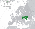
ስዕል:Europe-Ukraine.svg
Appearance

Size of this PNG preview of this SVG file: 713 × 600 pixels. Other resolutions: 285 × 240 pixels | 571 × 480 pixels | 913 × 768 pixels | 1,218 × 1,024 pixels | 2,435 × 2,048 pixels | 2,045 × 1,720 pixels.
ዋና ፋይል (የSVG ፋይል፡ በተግባር 2,045 × 1,720 ፒክስል፤ መጠን፦ 7.33 MB)
የፋይሉ ታሪክ
የቀድሞው ዕትም ካለ ቀን/ሰዓቱን በመጫን መመልከት ይቻላል።
| ቀን /ሰዓት | ናሙና | ክልሉ (በpixel) | አቅራቢው | ማጠቃለያ | |
|---|---|---|---|---|---|
| ያሁኑኑ | 17:19, 12 ዲሴምበር 2022 |  | 2,045 × 1,720 (7.33 MB) | Alexassandro | Reverted to version as of 14:22, 11 August 2015 (UTC) |
| 01:18, 10 ማርች 2017 |  | 2,045 × 1,720 (7.34 MB) | Geom10 | fixed disputed borders | |
| 14:22, 11 ኦገስት 2015 |  | 2,045 × 1,720 (7.33 MB) | Seryo93 | border is suitable for uncontrolled-territory variant | |
| 08:29, 11 ኦገስት 2015 |  | 2,045 × 1,720 (7.33 MB) | Seryo93 | Second attempt at uploading | |
| 08:24, 11 ኦገስት 2015 |  | 2,045 × 1,720 (7.33 MB) | Seryo93 | Isthmus of Perekop was too wide. Updated to match File:Europe-Ukraine (disputed territory).svg (except colour, of course) | |
| 16:03, 19 ማርች 2014 |  | 2,045 × 1,720 (2.7 MB) | A.Savin | Reverted to pre-editwar state | |
| 20:06, 18 ማርች 2014 |  | 2,045 × 1,720 (2.71 MB) | Артур михайлович | Reverted to version as of 17:05, 18 March 2014 | |
| 17:06, 18 ማርች 2014 |  | 2,045 × 1,720 (2.71 MB) | Misha motsniy | по примеру с оккупироваными териториями Грузии и Кипра | |
| 17:05, 18 ማርች 2014 |  | 2,045 × 1,720 (2.71 MB) | Misha motsniy | по примеру с оккупироваными териториями Грузии и Кипра | |
| 17:04, 18 ማርች 2014 |  | 2,045 × 1,720 (2.71 MB) | Misha motsniy | по примеру с оккупироваными териториями Грузии и Кипра |
መያያዣዎች
ወዲህ ፋይል የተያያዘ ገጽ የለም።
ሌሎች ውኪዎች
የሚከተሉት ሌሎች ውኪዎች ይህን ፋይል ይጠቀማሉ፦
- Usage on be-tarask.wikipedia.org
- Usage on be.wikipedia.org
- Usage on dsb.wikipedia.org
- Usage on en.wikipedia.org
- Usage on fi.wikipedia.org
- Usage on ja.wikipedia.org
- Usage on ka.wikipedia.org
- Usage on lv.wikipedia.org
- Usage on mk.wikipedia.org
- Usage on nn.wikipedia.org
- Usage on rue.wikipedia.org
- Usage on th.wikipedia.org
- Usage on uk.wikipedia.org
View more global usage of this file.

