
ስዕል:Map of Great Barrier Reef Demis.png
Size of this preview: 535 × 599 pixels. Other resolutions: 214 × 240 pixels | 429 × 480 pixels | 945 × 1,058 pixels.
ዋና ፋይል (945 × 1,058 ፒክስል፤ መጠን፦ 200 KB፤ የMIME ዓይነት፦ image/png)
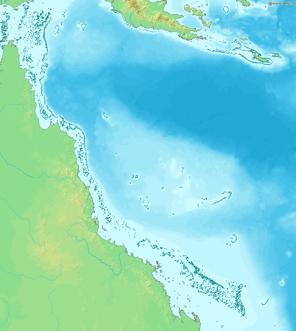
Map of Great Barrier Reef.
Bounding box West 142°, South -23°, East 155°, North -9°. Center at 16°00′00″S 148°30′00″E / 16.00000°S 148.50000°E.
This image is in the public domain because it came from the site https://www.demis.nl/products/web-map-server/examples/ and was released by the copyright holder. Permission is granted to copy, distribute and/or modify this map since it is based on free of copyright images from: www.demis.nl. See also approval email on de.wp and its clarification.
|
| This work has been released into the public domain by its copyright holder, www.demis.nl. This applies worldwide. In some countries this may not be legally possible; if so: www.demis.nl grants anyone the right to use this work for any purpose, without any conditions, unless such conditions are required by law.
|
የፋይሉ ታሪክ
የቀድሞው ዕትም ካለ ቀን/ሰዓቱን በመጫን መመልከት ይቻላል።
| ቀን /ሰዓት | ናሙና | ክልሉ (በpixel) | አቅራቢው | ማጠቃለያ | |
|---|---|---|---|---|---|
| ያሁኑኑ | 16:11, 20 ዲሴምበር 2006 | | 945 × 1,058 (200 KB) | Mats Halldin~commonswiki | Map of Great Barrier Reef. Bounding box West 142°, South -23°, East 155°, North -9°. Center at {{coor d|16.00000|S|148.50000|E|scale:8400000}}. {{demis-pd}} Category:Maps of Australia |
መያያዣዎች
የሚከተለው ገጽ ወደዚሁ ፋይል ተያይዟል፦
ሌሎች ውኪዎች
የሚከተሉት ሌሎች ውኪዎች ይህን ፋይል ይጠቀማሉ፦
- Usage on af.wikipedia.org
- Usage on ar.wikipedia.org
- Usage on as.wikipedia.org
- Usage on bn.wikipedia.org
- Usage on br.wikipedia.org
- Usage on bs.wikipedia.org
- Usage on ckb.wikipedia.org
- Usage on en.wikipedia.org
- Usage on es.wikipedia.org
- Usage on fiu-vro.wikipedia.org
- Usage on fo.wikipedia.org
- Usage on fr.wikipedia.org
- Usage on gan.wikipedia.org
- Usage on he.wikipedia.org
- Usage on id.wikipedia.org
- Usage on ja.wikipedia.org
- Usage on jv.wikipedia.org
- Usage on ka.wikipedia.org
- Usage on kn.wikipedia.org
- Usage on la.wikipedia.org
- Usage on mai.wikipedia.org
- Usage on mk.wikipedia.org
- Usage on ml.wikipedia.org
- Usage on mr.wikipedia.org
- Usage on ms.wikipedia.org
- Usage on ne.wikipedia.org
- Usage on new.wikipedia.org
- Usage on oc.wikipedia.org
- Usage on pnb.wikipedia.org
- Usage on sah.wikipedia.org
- Usage on sh.wikipedia.org
- Usage on sk.wikipedia.org
- Usage on ta.wikipedia.org
- Usage on th.wikipedia.org
- Usage on ur.wikipedia.org
- Usage on vep.wikipedia.org
- Usage on xmf.wikipedia.org
- Usage on yi.wikipedia.org