
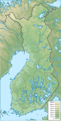
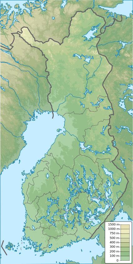
ስዕል:Finland physical map.svg

Size of this PNG preview of this SVG file: 303 × 598 pixels. Other resolutions: 121 × 240 pixels | 243 × 480 pixels | 389 × 768 pixels | 518 × 1,024 pixels | 1,037 × 2,048 pixels | 427 × 843 pixels.
ዋና ፋይል (የSVG ፋይል፡ በተግባር 427 × 843 ፒክስል፤ መጠን፦ 3.97 MB)
ማጠቃለያ
| ማጠቃለያ |
English: Finland physical map, parameters equal to File:Finland location map.svg |
| ቀን | |
| ምንጭ | Own work |
| አቅራቢው | Urutseg |
የፈቃድ አይነት፦
| I, the copyright holder of this work, release this work into the public domain. This applies worldwide. In some countries this may not be legally possible; if so: I grant anyone the right to use this work for any purpose, without any conditions, unless such conditions are required by law. |
የፋይሉ ታሪክ
የቀድሞው ዕትም ካለ ቀን/ሰዓቱን በመጫን መመልከት ይቻላል።
| ቀን /ሰዓት | ናሙና | ክልሉ (በpixel) | አቅራቢው | ማጠቃለያ | |
|---|---|---|---|---|---|
| ያሁኑኑ | 12:09, 26 ጃንዩዌሪ 2021 | | 427 × 843 (3.97 MB) | Fenn-O-maniC | Updated regional borders as per https://asiointi.maanmittauslaitos.fi/karttapaikka/ |
| 23:39, 25 ኖቬምበር 2019 |  | 427 × 843 (3.99 MB) | Pavouk | update border North_Ostrobothnia (+Vaala), delete Eastern Uusimaa, change border (Aland inside Finland, not out) | |
| 13:54, 13 ፌብሩዌሪ 2011 |  | 427 × 843 (3.99 MB) | Urutseg | {{Information |Description ={{en|1=Finland physical map, parameters equal to File:Finland location map.svg}} |Source ={{own}} |Author =Urutseg |Date =2011-02-13 |Permission = |other_versions = }} [[C |
መያያዣዎች
የሚከተለው ገጽ ወደዚሁ ፋይል ተያይዟል፦
ሌሎች ውኪዎች
የሚከተሉት ሌሎች ውኪዎች ይህን ፋይል ይጠቀማሉ፦
- Usage on av.wikipedia.org
- Usage on az.wikipedia.org
- Usage on be.wikipedia.org
- Usage on bn.wikipedia.org
- Usage on bs.wikipedia.org
- Usage on ca.wikipedia.org
- Usage on ceb.wikipedia.org
- Usage on ce.wikipedia.org
- Usage on ckb.wikipedia.org
- Usage on da.wikipedia.org
View more global usage of this file.